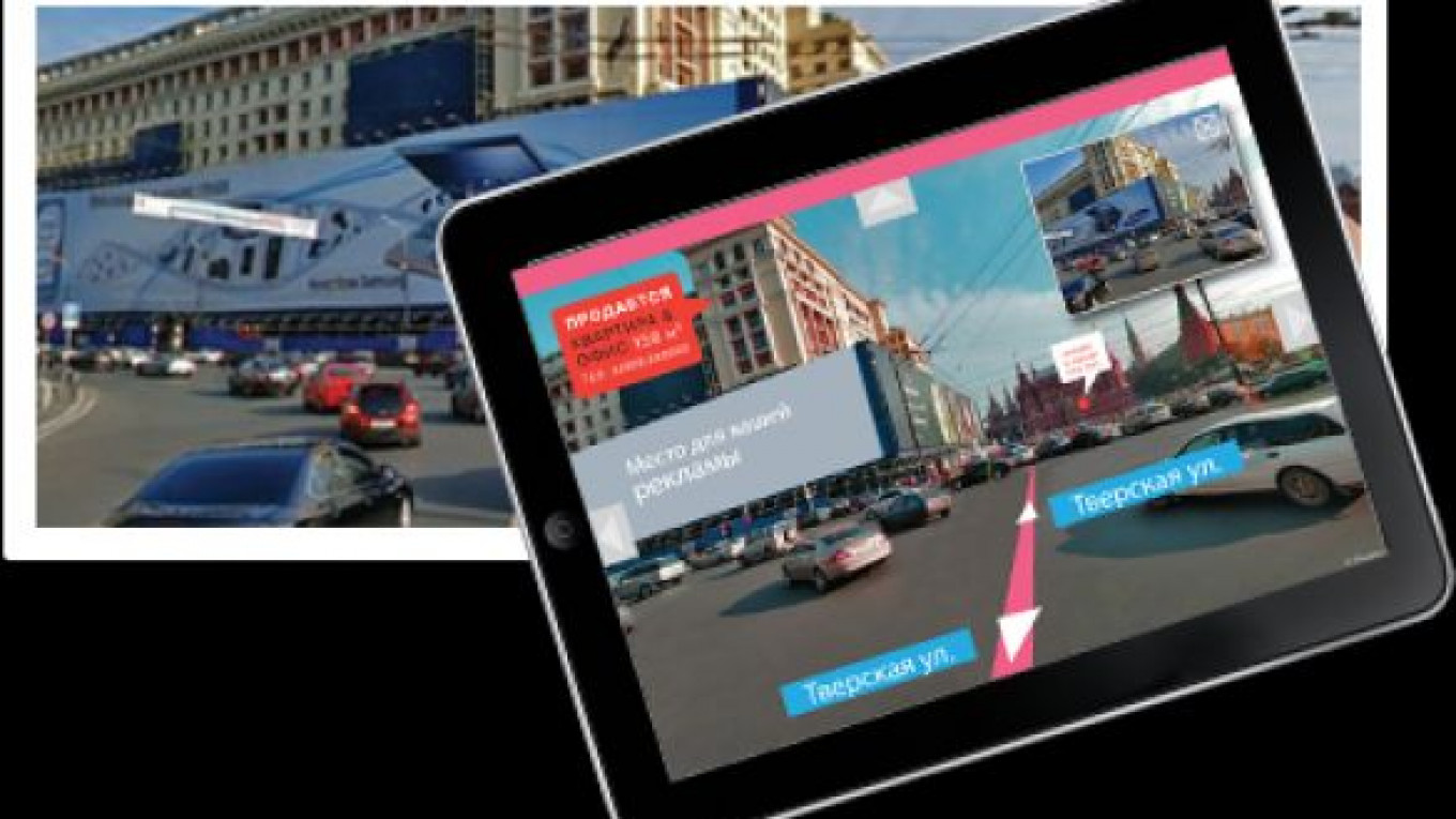
IT Geo has won a Moscow government contract worth more than 30 million rubles ($1 million) to create a high-definition 3D panorama of the city using laser scans, a news report said.
The 3D images will primarily be used by City Hall for urban management purposes, but some will also be made available to the public via the eatlas.mos.ru website before the end of 2013, Vedomosti reported.
Moscow-based IT Geo and its partner in the project, HelgiLab, have so far photographed and scanned 6,000 kilometers of Moscow's streets over the past three months, IT Geo said in a statement on its website. Those images are being updated regularly, IT Geo director Sergei Gevorkov said.
Google Street View and Yandex Maps already offer 3D images of Moscow, but Gevorkov and HelgiLab chief Oleg Ilichev said that those views are based on photography alone, not a combination of photography and laser scans.
Unlike photographs, laser scans can be used to make 3D views that can then be linked with geographical coordinates and applied to various urban information databases, Ilichev said.
Comparing regularly updated panoramic images with cadastral maps would let the authorities track any unauthorized construction in the city, and create and an inventory of smaller objects that might spring up, such as kiosks and road signs, he said.
Yandex Maps attracts more than 23 million visitors each month, who frequently use street views to verify a route or check road signs, said Yandex spokeswoman Asya Melkumova, adding that the company wasn't worried about losing visitors to the City Hall project.
Gevorkov declined to say exactly how much the project would cost, saying only that it might be more costly than Google's or Yandex's photography of Moscow.
A Message from The Moscow Times:
Dear readers,
We are facing unprecedented challenges. Russia's Prosecutor General's Office has designated The Moscow Times as an "undesirable" organization, criminalizing our work and putting our staff at risk of prosecution. This follows our earlier unjust labeling as a "foreign agent."
These actions are direct attempts to silence independent journalism in Russia. The authorities claim our work "discredits the decisions of the Russian leadership." We see things differently: we strive to provide accurate, unbiased reporting on Russia.
We, the journalists of The Moscow Times, refuse to be silenced. But to continue our work, we need your help.
Your support, no matter how small, makes a world of difference. If you can, please support us monthly starting from just $2. It's quick to set up, and every contribution makes a significant impact.
By supporting The Moscow Times, you're defending open, independent journalism in the face of repression. Thank you for standing with us.
Remind me later.